|
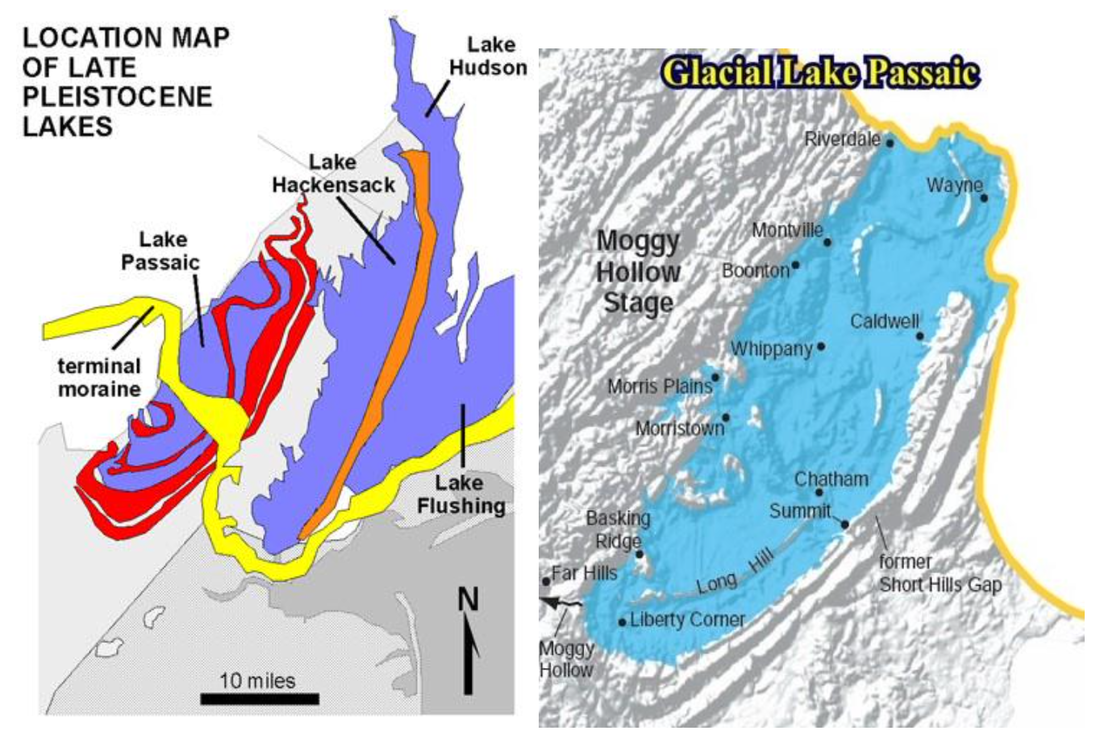
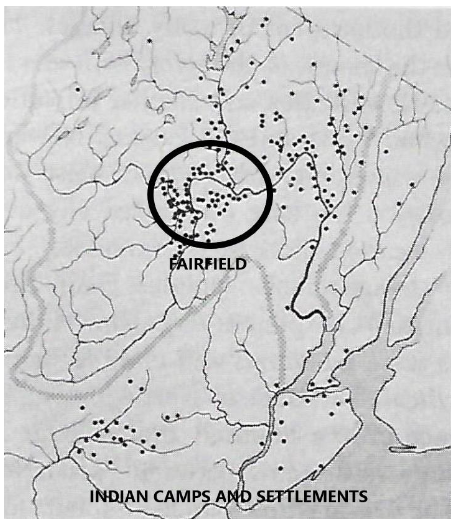
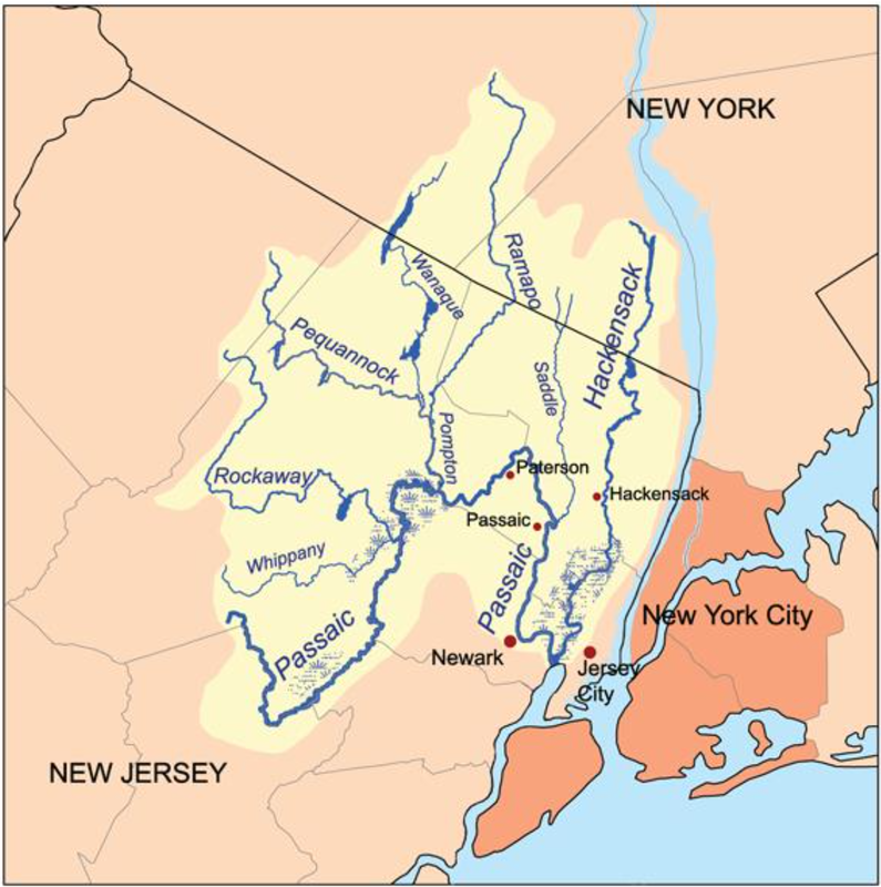
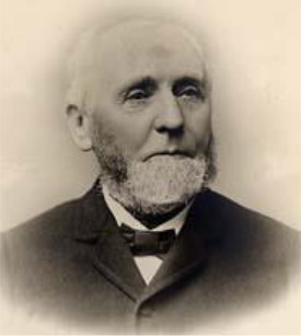
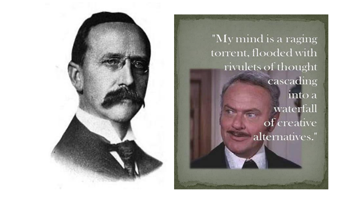
George Hammell Cook was raised on a small farm in Hanover, NJ, in the early 1800s. In 1853 at the invitation of then President Theodore Frelinghuysen he joined Rutgers College as professor of chemistry and natural sciences. Cook had expertise in geology, chemistry, engineering, and agriculture. In 1864 Dr. Cook was appointed State Geologist of New Jersey and also became Vice President of Rutgers College. In New Jersey’s 1880 Geological Survey, Dr. Cook and his Staff first revealed conclusive evidence that a large lake was formed as New Jersey’s last great glacier melted and receded north about 18,000 years ago. Fairfield was first covered by a 1,200 foot deep ‘river of ice’ that sculpted the Passaic Valley between the Watchung Mountains to the East and the New Jersey Highlands to the West. This large glacial lake was approximately 30 miles long, 8 to 10 miles wide, and up to 200 feet deep. Although this ‘discovery’ paled in comparison to Thomas Edison’s inventions at the time - to a 19th century Geologist - this was ‘most remarkable and interesting.’ It’s difficult to fathom :- ) 180 centuries of natural erosion and geologic evolution, but its safe to conclude that the sedimentation and alluvial deposits into Lake Passaic eventually created Fairfield’s top soils. The sandy soil outcroppings in the Passaic Valley Basin were nearly ideal for agriculture. However, pure sand lacks organic nutrients and is often considered ‘poor’ when compared to many of the other 18 N.J. soil classifications. The Lenape Indians were our first local Farmers with their ‘large-scale agriculture’ compared to other Indian Nations to their North and West that were almost exclusively hunter gatherers. The Lenape men limited their agricultural labor to clearing the field and breaking the soil. Fairfield’s sandy soils were more easily cultivated with their crude tools but it was not as productive as other nutrient rich soils. Even more important to the Lenape were the Passaic River and its tributaries that provided a transportation network that greatly enhanced their hunting-gathering range. This network of rivers flowing into Fairfield’s Western border ( Rockaway and Whippany Rivers ) and Eastern Border ( Pompton, Pequannock, Ramapo, Wanaque, and Mahwah Rivers ) form – what I call – the ‘Fairfield Watershed’. This unfortunate fact will surface :- ) again in our later discussion of the local “F” word ( Flooding ! ). The Lenape also burned off their fields and meadows to ‘control’ vegetation and sometimes drive deer into the rivers where they could easily spear or club them from canoes. When the local Indian population diminished their abandoned fields were very attractive to the first Frontier Farmers ( sometimes called “Holland Immigrants” ) to enter the valley for settlement.. As one local Historian ( John Whitehead 1901 ) suggested : try to imagine yourself as the very first European to view the western valley from the top of Second Watchung Mountain. It’s my guess that you would most likely see undrained meadow bottom and wet swamps surrounding vast tracts of sandy outcroppings. The Greenbrook and other Second Mountain streams and springs emptying into the Long Meadow Swamp, then draining into the Passaic River via the naturally formed Deepavaal Brook. It wasn’t perfect land, but rudimentary drainage could greatly expand the already cultivatable sections ; the coarse meadow grasses could be replaced with finer European pasture hay varieties ; and the sandy soil could be enriched with manure or other organic materials like peat. ***** Circling back to George H. Cook as Head of the Rutgers Scientific School ( often incorrectly called the ‘Agricultural College’ ), he distinguished himself by securing New Jersey’s ‘Land Grant College’ status and establishing the N.J. State ( Agricultural ) Experiment Station supporting all 21 N.J. Counties. Concurrently, as New Jersey State Geologist, his small Staff surveyed and topographically mapped the entire State, and provided expert engineering consultation on numerous water supply, drainage, mining, archeological, weather and museum related projects. Cook’s many earthly :- ) accomplishments are well documented in his biography : “George Hammel Cook : A life in agriculture and geology”. ( available through interlibrary loan ). George Hammell Cook, New Jersey’s first true ‘Rock Star’ :- ) One of George H. Cooks engineering students Clarence Cornelius Vermeule graduated Rutgers in 1878 and immediately began working for his mentor as a “Topographer and Surveyor”. It took ten years, but they shared the incredible accomplishment of topographically mapping the entire state, and became the first state to do so. ( I guess Delaware and Rhode Island should have beat them, huh ? ). While Vermuele was still a student in 1875, the Mayors of Newark and Jersey City requested NJGS to study their city water supply difficulties. ( Please recall previous articles detailing the contaminated city water and 20% child mortality rates in the late 1800’s ). 20 and 25 years later, these Cities ran ( phase one ) pipelines from the Boonton Reservoir ( to Jersey City ) and the Pequannock Watershed ( to Newark ) with great success. Some waterborne diseases were reduced 70% immediately. By this time George H. Cook had passed away and C.C. Vermuele had established himself as one of the Nation’s leading experts on water power and water supply. Vermuele maintained his close ties to the NJGS and also opened a private practice as a Consulting Engineer. ***** Vermuele was familiar with significant Passaic Valley floods during 1882 and 1896, but in 1902 a February ‘snow melt’ intensified flood was the second largest since records were kept ( 1810 ). Among other earlier small to medium scale proposals by the NJGS, Vermuele now jumped in with a new plan to build a ‘flowing dam’. Such a dam above Little Falls would assure that no flood waters exceeded the capacity of the lower Passaic River through the commercial, industrial, and densely inhabited communities. Unfortunately, such a dam increases flood waters above the dam and adds 3-5 days more to the length of the flood event there. Too bad Fairfield, Singac, Lincoln Park, Wayne, etc. These “undeveloped” farmlands and unsightly lowlands would be forced to ‘suffer in silence’ for Northern N.J.’s greater good. Only four months after the 1903 NJG Survey was delivered to the Governor with Vemuele’s proposed ‘flowing dam’, the great Flood of 1903 struck with devastation never seen before or since. Hurricane Irene Flooding in 2011 came close, but the October 1903 Flood remains our very worst of all time. ( Captain ) Vermuele now had his ‘white whale’ to conquer, and he pledged a detailed solution for the 1905 NJG Survey. C.C. Vermuele ( L ) and an appropriate quote from Hedley Lamarr in Blazing Saddles 1974 Thus, Vermuele ‘doubled down’ in the 1905 NJGS and proposed a full scale $10,000,000 Project that would result in a 35,000 acre reservoir ( this is 5 times the surface area of Lake Hopatcong, Greenwood Lake, and the Wanaque Reservoir combined ! ). The following benefits were detailed by ( Captain ) Vermuele :
0 Comments
|
 RSS Feed